- Product Description
|
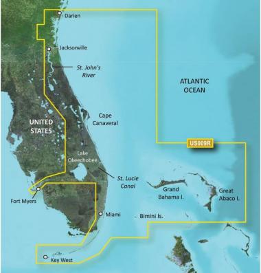
This chart is NOT compatible with GPSMAP 722sx, 7612xsv, 7610xsv, 922xs, Echomap Plus series or units with the latest update software/firmware. BlueChart g2 Vision - VUS009R - Jacksonville - Key West - microSD/SDSee your vessel''s precise, on-chart position in relation to navaids, coastal features and restricted areas with premium features found in this detailed marine mapping data. Includes all of the features of our BlueChart g2 product, plus 3-D perspective above and below the waterline, Auto Guidance, high-resolution imagery, and aerial photos of ports, harbors, marinas and landmarks.Coverage:Featuring data from the Explorer Charts of the Bahamas. Darien, GA to Key West, FL including the entire St. John''s River, the St. Lucie Canal, Lake Okeechobee, with coverage over to Ft. Myers. Also includes detailed coverage of Bimini, the Abacos and Grand Bahama Island. Product information
Additional InformationImportant information
Legal Disclaimer :I am the owner of this product |

