- Product Description
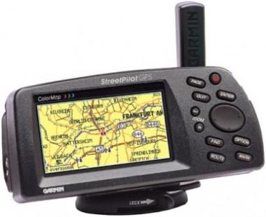
Amazon.comDesigned primarily for the automobile, the basemap data of Garmin''s StreetPilot GPS ColorMap displays exit information for the federal interstate highway system, information such as available food, lodging, and service stations. It also contains a reference basemap showing interstate, U.S., and state highways, plus rivers and lakes in the United States, Canada, and Mexico, with main arterial streets shown in metropolitan areas. You can plug in optional data cards (MetroGuides) for street-level map detail, access to business listings, and points of interest in your area. The ColorMap features a high-performance GPS receiver with 12 parallel channels for quick satellite acquisition and reliable signal reception, whether you''re under dense tree cover or surrounded by high-rise skyscrapers. The high-resolution, 16-color display makes map reading easier. The Garmin StreetPilot GPS ColorMap shows text and graphics in large type for viewing convenience, and has a screen brightness adjustment and a night mode that alter the display colors for viewing in dim ambient conditions. The unit also comes with a free cigarette lighter adapter so you won''t always have to rely on battery power. The StreetPilot ColorMap works in trucks and vans as well. Features & detailsFeatures
Product information
|

